Smallholder farmers in Ghana’s Central Region face a range of challenges in producing prime varieties of pineapple. The University of Cape Coast is implementing a project using drones and precision agriculture to to assist farmers upscale pineapple production to a commercial level. Aerial views and advice based on index maps generated using drone technology, enabled them to be more effective and efficient in managing their crops and ensure improved plant growth and higher yields.
The smallholder pineapple farmers face numerous challenges when producing marketable pineapple varieties such as “MD2” and “Smooth Cayenne” for export and agro-processing industries. Most smallholder farmers in the Central Region of Ghana produce pineapple variety named “Sugar Loaf” which mainly sells at the local market and at low prices, leading to low income level of farmers. The situation makes pineapple cultivation unattractive. Meeting the demands of the export market and agro-processing industries is one way for smallholders to increase their incomes and improve their livelihoods.
Relevant and real-time information on the pineapple production process are required by farmers to produce the varieties that are important for the market (MD2 & Smooth Cayenne) and in the most productive way. Information required include how to prepare land—which could be determined by the land size and shape; relevant information on agrochemicals to use could determine the health status and the nutritional requirements of the crop. Unfortunately for most smallholder farmers, such information is not always and easily available.
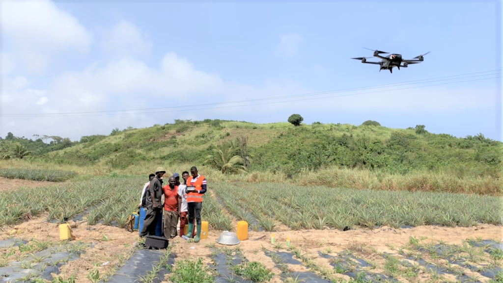
The drone technology has the potential to provide reliable information based on the farmers’ own land and crops’ requirements to optimise crop production, produce high quality fruits, minimise production cost, and meet consumer preferences. The drone technology, Parrot Bluegrass used by the University of Cape Coast has the capacity for mapping, farm field surveys, and creating precision maps to measure crop health and performance.
The drone demonstration
The Department of Agricultural Economics and Extension of the University of Cape Coast, with the support of the Technical Centre for Agricultural and Rural Cooperation ACP-EU (CTA), the MasterCard Foundation and the Regional Universities Forum for Capacity Building in Agriculture (RUFORUM) implemented a project to assist farmers optimise pineapple production to a commercial scale. The project was conducted in a pineapple-growing community called Nsadwir. It has a population of about 2,000, and it is located in the Komenda Edina Eguafo District, in the Central Region of Ghana. The project among others intended to measure the potential benefits of the drone technology on the community’s pineapple production systems, and contribute to the livelihoods of farmers.
The project started with a focus group discussion with 30 smallholder farmers (24 men and 6 women) in Nsadwir, in March 2019.
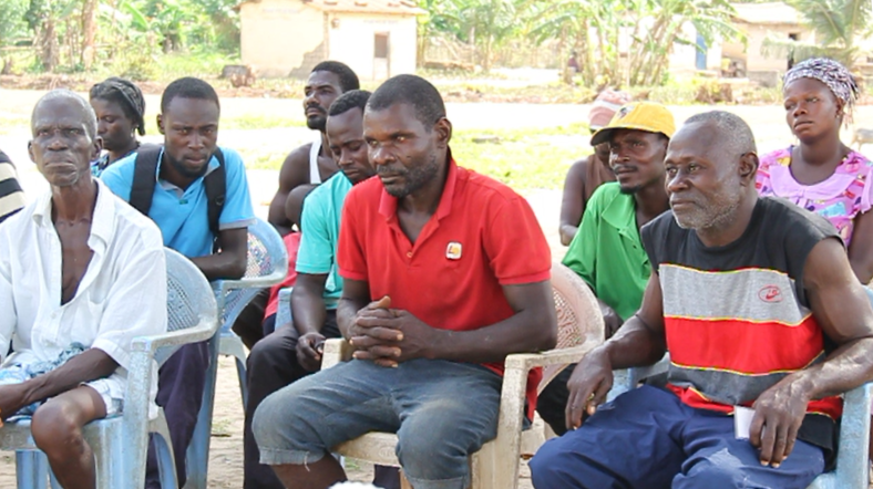
The FGD enabled the project team to explain the objectives of the project, confirmed the challenges faced by farmers; confirm the participation of farmers interested in the demonstration, and solicited views of farmers on setting up a demonstration field for learning. The outcome of the FGD was that the demonstration would be used to cultivate Smooth Cayenne and MD2 pineapple varieties; the drone technology would be used to collect data and provide relevant information to be used on the demonstration field; and the participating farmers would monitor the crops and use the relevant information to improve productivity of the pineapples.
Of the 30 farmers who showed up for the meeting, 15 decided to join. The farmers who did not show interest mentioned different reasons, such as not wanting to commit themselves to a long-term process of producing pineapples for 14 to 16 months, especially when combining with other farming activities. Interestingly, 70% of the farmers who showed interest were between the ages of 18-35 years. The older farmers had less interest in Information and Communication Technologies (ICTs) and depend largely on their indigenous knowledge, therefore could not be involved in the drone technology.
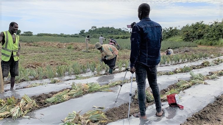
The project team and farmers established the demonstration plot in May, 2019. The male participants carried out the labour intensive and energy required activities such as land clearing, breaking of soil clods, making of beds, mulching, and planting whereas the female farmers, who were three in number sort and convey planting materials for planting on the field. However, both male and female farmers carried out other agronomic activities such as weed control, fertilizer application, pest control and prevention, all based on the precision farming principles shared by the project team.
The drone, a Parrot Bluegrass, was used to map the demonstration plot, and also captured initial relevant agronomic data of plants on the field. The map enabled farmers appreciate the shape and size of the demonstration plot. The sensors of the drone collect multispectral and RGB (Red, Green, Blue) imagery of the pineapple crops. The captured imagery were processed to generate index maps. These index maps showed the chlorophyll content of individual pineapple plants which were used to estimate the nutrient requirement of plants, and provides recommended fertilisers to be applied by the farmers. .
Impact on livelihood of farmers
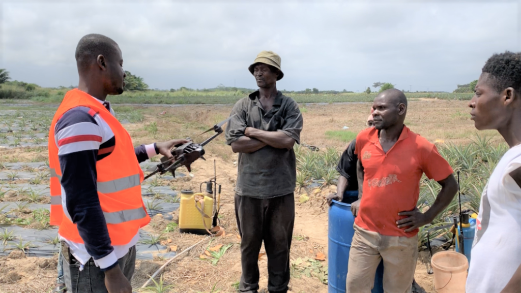
The research team measured the impact of the drone technology on farmers’ livelihoods in terms of crop performance which is likely to generate large income and changes in competencies in pineapple production. The experience with farmers with respect to management of the demonstration plot prompted the team to share knowledge on principles of precision agriculture to the farmers. Farmers learnt about the type, quantity and effect of various elements in a fertilizer and pesticide application, and the need to use these agrochemicals effectively and efficiently without causing harm to the environment.
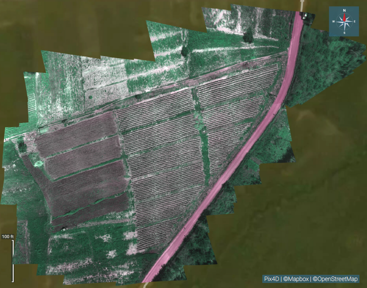
RGB composite image of pineapple fields 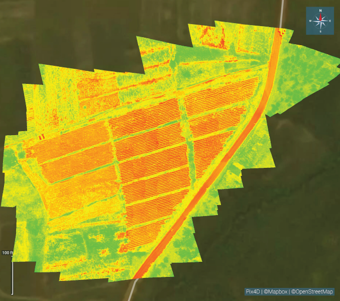
NDVI index map of the same fields
From the RGB images and index maps developed using multispectral imagery, smallholder farmers were able to gain an enhanced bird’s eye view of the demonstration plot. The group discussions helped farmers to discover the relationship between (i) land size and the crop density, (ii) land size and the quantity of agrochemicals required, and (iii) the costs involved in the production of a particular area. The map from the drone technology demonstrated the importance of having clear plot boundaries to prevent conflicts and disputes with neighbours as well as optimisation of land use. Hitherto, traditional process of determining plot boundaries was not as precise, usually being orally transmitted, and depends on the location of natural boundaries such as trees and stumps.
Moreover, the map and size of the demonstration plot from the drone technology enabled farmers to plan various road paths, and number of ridges to construct on the plot. The pineapple farmers proved to be knowledgeable and well informed in crop husbandry. Farmers were in the position to prepare the land properly to allow the soil retain sufficient moisture for plant growth, and used a bed height of about 20 centimetres with breadth of one meter, and a length of 100 meters to improve drainage.
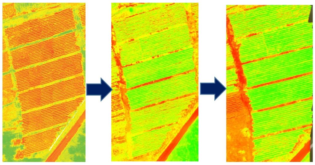
The NDVI index maps showed significant changes in growth of the pineapple plants months after the application of various agronomic practices. The applications were dependent on information from previously obtained NDVI index maps of the demonstration plot. Farmers subsequently planned on the appropriate and adequate usage of agrochemicals based on the colour bands of the NDVI index maps. The different colours on the map signify health status of the pineapple. For instance, the red colour shows poor performing crops, yellow coloration shows an intermediate performance, and a green colour shows healthy crops and better (expected) yields. The farmers understood that the red area on the index map needed more attention when applying fertilisers or pesticides. The use of agrochemicals in this way became demand-driven and characterised by location and specific application. Farmers anticipated high yield from the demonstration field as the time sequence of index maps demonstrated a positive change in pineapple growth in response to geo-located crop husbandry practices applied by the farmers.
Conclusion
The research conducted among smallholder pineapple farmers has proven that precision farming advisory based on drone technology has brought about improvement in land use and crop performance. Even more importantly, farmers have developed specific skills and acquired knowledge on innovative technologies for agriculture. For them, it has not necessarily become easier to grow pineapples, but the field’s productivity has improved thanks to acting based on real-time drone-tech generated advice. This confirms that at least in some aspects, drone technology could improve the livelihoods of smallholder pineapple farmers. A statement by a farmer perhaps summaries everything “I am amazed with some of these new technologies used in agricultural production. It has rekindle my interest in pineapple production. I am willing to learn more from the University of Cape Coast research team.” The project team and farmers expect to learn more about the financial, physical and social consequences of using drones in pineapple production as the project progresses.
Authors’ references:
Zikiru Shaibu
University of Cape Coast, Department of Agricultural Economics and Extension, Ghana
Email: zikiru.shaibu@stu.ucc.edu.gh
Festus Annor-Frempong
University of Cape Coast, Department of Agricultural Economics and Extension, Ghana
Email: fannor-frempong1@ucc.edu.gh
Selorm Akaba
University of Cape Coast, Department of Agricultural Economics and Extension, Ghana
Email: sakaba@ucc.edu.gh