Remote sensing and artificial intelligence (AI) are being used by agri-tech start-up SOWIT to help African farmers in 15 countries optimise their crop yields.
For Hamza Bendahou and Rkha Chaham, tomorrow’s agriculture will involve planting, fertilisation and irrigation, while also tapping the potential of algorithms and AI. These young entrepreneur and co-founder of SOWIT, a start-up that provides “decision support systems that allow African farmers to optimise their operations efficiently and sustainably,” are committed to harnessing the power of drone- and satellite-based remote sensing and big data to fill the agricultural information void across the continent.
Founded in 2017, SOWIT has offices in France, Morocco and Senegal providing decision-making tools using state-of-the-art agricultural technology. The company combines field measurements, satellite images and more precise images captured by drones, supported by algorithms, to help farmers across 15 African countries to assess water and input needs and determine ideal harvesting times.
“AI enables us to better foresee how a situation will develop with less data,” explains Chaham. “We collect information such as the reflectance (ratio of the amount of light reflected by plant leaves to the amount absorbed), plant architecture, size, etc. All of this gleaned crop information is dovetailed in a smart way with data gathered in the field. The aim is to ensure that the match between the virtual measurements and the actual situation in the field is reliable.”

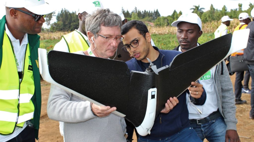
© Giacomo Rambaldi / CTA
Better forecasting with less data
In Morocco, where SOWIT is firmly established, Abdelaziz Mernissi, a wheat, barley and olive producer in Saiga region, says, “In 2018, the lack of information regarding the main production operations (preliminary cultivation, seeding, fertilisation, crop protection, harvesting and marketing) held me back from making the most of the cropping season, despite the fact that we had benefited from more than 500 mm of evenly distributed rainfall.” He continues, “Yields were 6 t/ha in some parts of the field while, in others, we were only getting 1 t/ha.”
However, after mapping his field, SOWIT analysed the resulting data and provided Mernissi with a detailed real-time assessment of his crops (including crop health, growth and water needs), and an estimate of fertiliser requirements. SOWIT also helped Mernissi identify different factors that could be deployed to improve his yields: optimal sowing date, the most accurate amounts of fertiliser to apply, irrigation tailored to the observed water stress conditions, etc. With this field intelligence, Mernissi was able to save 33 kg/ha of fertiliser, representing per-hectare gains of more than DH 700 (€65.74).
Precision drone imaging
In Sudan, SOWIT supports farming companies growing alfalfa, which is an important forage crop for livestock feed while also being a mainstay of the country’s export economy. Alfalfa growers are hampered by high costs of imported fertiliser. “Our drone operator will assist these farmers throughout the season, provide them with information on the fertilisation and harvest period, and indicate exact fertiliser amounts to apply, and where, in order to maximise yields”, says Chaham.
Satellite images may be helpful in this quest, but are limited to a few pixels per hectare and thus can only serve to take into account the heterogeneity of the fields. Conversely, the resolution of higher frequency drone images taken below the cloud cover can reach several million pixels per hectare. So these pictures generally contain a wealth of information to fine-tune crop forecasts. “Time and scale are our main obstacles [to achieving good yields],” explains Faisal Mohamed Ali, operations manager for DAL Agriculture, a Sudanese conglomerate. “Through drones, we know what’s going on (in the fields) and we can quickly intervene.”
Drone services are affordable for large-scale producers but less so for smallholder farmers cultivating small plots. SOWIT is working in Ethiopia with the Agricultural Transformation Agency (ATA) and the Ministry of Agriculture on a CTA-led project, and by August 2019 had trained six drone pilots and six data analysts to work with the Ethiopian agencies, which are planning to roll out the data analysis services to cooperatives across the country. “The pictures and videos [taken by drones] will be used for analysis and agronomic interpretation on yield and crop health, facilitating timely intervention,” says Techane Adugna, director of the Agricultural Commercialisation Cluster at ATA, while pointing out that, “The use of drones will also facilitate market linkage for the farmers by collecting real-time visuals from agricultural fields and sharing them with possible buyers.”
And what about smallholders?
Although SOWIT works with small-scale farmers in many African countries via cooperatives or government agencies, AI services can still be unaffordable for many African farmers. “It all boils down to economics of scale,” explains Giacomo Rambaldi, senior programme coordinator ICT4Ag at CTA and co-author, with Chaham, of Drones on the Horizon – Transforming Africa’s Agriculture, a report which the African Union used in January 2018 to recommend that all African states use drone technology. “Drone technology and related AI can be deployed among smallholder business-oriented farmers growing the same crop in contiguous areas. Packaging drone-based advisory as part of other services (credit, mechanisation, etc.) offered by cooperatives or agribusinesses to their members is also a win-win option.”
“CTA supported the conduct of applied research among smallholder farmers in Benin, Burkina Faso, Ghana and Rwanda (on-going),” Rambaldi explains. “The results of this research will form the stepping stones for farmers and other actors to take informed decisions on whether to trust, pilot-test and finally embrace this transformative technology.” For the time, being SOWIT and the likes are pioneers on the Africa continent.


