In Cameroon, the Agricultural Institute of Obala has introduced a module within its agricultural courses on the use of drones to improve farm productivity. The module teaches students about the potential of the technology to increase agricultural efficiency and reduce farm labour, with the aim of improving the image of agriculture among Cameroon’s youth.
For about 500 students training at the Agricultural Institute of Obala (IAO), the discovery of drone services for the agriculture sector has been the decisive element in settling on becoming agropastoral entrepreneurs. Drones are considered as a tool to acquire accurate and real-time data about farm plots in order to improve productivity, optimise yield, estimate production levels and thus, help develop product marketing plans.
The agricultural sector offers many opportunities in Cameroon. About three quarters of the 7 million ha of arable land are not exploited and the diversity of agro-ecological zones makes it possible to develop all kinds of crops. To reduce the country’s food import bills and cope with the high rate of youth unemployment and underemployment, the government has put in place several programmes in support of the policy to promote second generation agriculture. However, despite this supportive environment, the agricultural sector remains unattractive to young people who, generally, have a negative image of agriculture as a job. Such an image of agriculture means many young people tend to choose rural exodus, abandoning family farms to the older generations.
It is within this context that IAO, a pioneer in the training of rural entrepreneurs, included a module within their agricultural course on the use of drones for precision farming, during the academic year 2017-2018.
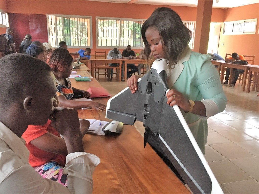
The purpose of the module is to introduce learners to the development of modern technologies needed to move from subsistence farming to intensive agriculture, which requires precision for productivity gains. The module, entitled The impact of the use of agricultural drone for agropastoral entrepreneur, is divided into two phases: a theoretical classroom phase at the IAO school campus and a practical phase at Batshenga (20 km from the school), in the institute’s corn production unit.
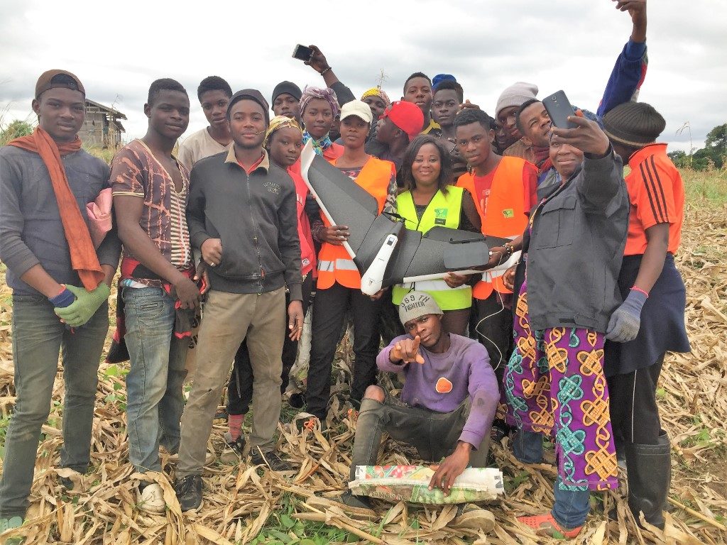
The first experiments made it clear that many learners had no idea about the applications of drones in the field of agriculture. Those who had heard of drones could only imagine applications in the field of photography, cinema and military operations. With this in mind, introduction to the module began with an inventory by the learners of the difficulties they face in creating and conducting their agricultural projects. Almost invariably, they came back with the same responses: delimitation of the parcels acquired; soil characterisation; the fight against plant pests and diseases; fertilisation; estimating production levels before harvest; risks related to produce losses; the arduousness of the work; acquiring the financial means; and commercialisation. For many of the students, these difficulties are barriers to engagement with farming.
After the inventory of the main difficulties, the module invites learners to consider potential solutions. During discussions on this subject, the answers were limited. Apart from ploughing, students were not able to produce any ideas of how to deal with the difficulties mentioned to increase efficiency and/or reduce farmer hardship. Delimitation of space and the calculation of farm areas require sufficient effort on large farms, either using a dekametre that requires the participation of at least four people, or by walking the parcel with a handheld GPS (unaffordable for most). As such, many farmers simply delineate their farms by planting all around their parcel, which takes up a significant amount of time and energy. However, as Pierre-Paul, agronomist and trainer at the IAO, emphasises, “The first goal of an agropastoral entrepreneur is to increase the productivity of each factor of production. It is important to think about the relationship that exists between mobilised resources and expected results.”
Drones offer solutions that are relevant to most of the difficulties identified by the learners, and their applications can be presented in three categories of service:
- Space security services: cartography and delimitation of parcels; characterisation and determination of parcel variation; determination of damage after fire or insect invasion.
- Performance and crop protection services: determination of exact fertilisation requirements; surveillance of the evolution of cultures; analysis of plant diseases; management of plant water needs.
- Production estimation services: counting of fruit plants; estimation of damage in case of fire; surveillance of plant growth progression.
Interest of the learners regarded, in particularly, accuracy of the data obtained from drones, which considerably reduces the time and toil required for agricultural tasks. Fertiliser management, for example, which usually takes up a lot of time and resources, is optimised. Drones make it possible to determine precisely any variations in plant development on the farm, locating and evaluating the fertiliser needs for specific areas. In contrast, using traditional methods, the farmer would have to apply the same fertiliser treatment across his entire plantation.
The last part of the classroom aspect of the module was reserved for discussions between students on their learning outcomes. Most of the responses underlined the link between drone services and increased farm productivity. Some queries were raised, however, regarding the efficacy and need for drones. As an example, one learner felt that drone services do not have a comparative advantage in the diagnosis of plant diseases; she said, “Plant diseases are visible to the naked eye: when the plant is green, it is healthy and when it is yellowish or red it is not good.” Her classmates argued against this point, highlighting the use of drones to examine crops on large-scale, high-intensive farms, where checking each plant by eye would be a painstaking task, whilst drones can cover 40 ha in less than 10 minutes.
The discussions between learners ended on a question of the contribution of drones to improve commercial strategies. Drones make it possible to count agricultural products and, due to this point, the students noted that a farmer can more easily estimate his turnover, the profitability of his harvest and establish a plan of sale. As a result, farmers can establish contact with prospective buyers, suppliers of agricultural inputs and banks and provide reliable harvest estimates.
In summary, the learners came to the conclusion that drones provide crucial information for setting up a business plan, conducting agricultural production operations and developing sales plans. This conclusion goes some way in reflecting the extent of interest among the youths, as generated by the module, in using drones for agriculture.
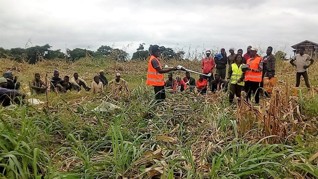
The second phase of the module is the practical phase and activities are carried out in the maize production unit of Batshenga – a 60 ha site. After brief reminders about the different uses and services of agricultural drones, two flights were made, changing the altitude and speed of the drone. The data collected were analysed (delimitation and area size, photos of the parcel, etc.). The process of analysing the data of previous missions for the same parcel using laboratory equipment (such as PIX4D, AIRINOV control tour) was also presented to the students.
At the end of this exercise demonstrating the services of the drone, several young people were galvanised and encouraged to work in the agricultural sector. The module thus had an impact on the professional orientation for the young entrepreneurs. However, for those considering entering the sector, the question regarding how to access drone services once they became available in the different regions of the country, remained. A valid question that also revealed another opportunity for the students: that of developing initiatives to facilitate access to technologies to support so-called second-generation agriculture in Cameroon. While waiting for a nationwide response, IAO guarantees to its learners and interested agro-pastoral project owners the services of its Parrot Disco Pro AG drone.
The experience shows that it is advisable to popularise the use of the agricultural drone to contribute to the improvement of farm productivity, and to the revaluation of the image of agriculture in the minds of Cameroon’s youth. As Louis Ndjie, Director General of the IAO points out, it is necessary to valorise such innovations “So that young people consider more and more the agro-pastoral sector, not as an archaic rural sector which requires a physical force, but as a business sector that creates wealth and jobs.” For this reason, it is advisable that a dedicated module on drones for agriculture be integrated into any training programmes for the country’s engineers and agricultural producers. IAO’s experience can thus be capitalised, consolidated and popularised in training circles for the agricultural producers of tomorrow.
About the Author:
Ms Nkoa Lucie Freddy
Lucie is a drone pilot and head of the drone service at the Agricultural Institute of Obala in Cameroon. Aware of the difficulties faced by farmers in the field, she offers support services and advice through the use of second-generation technologies that could improve their working conditions, allow them to save money and boost their productivity.
Email: lucifredy@gmail.com
