To help prepare a resettlement action plan, Geospatial Research Limited mapped farm plots, households and economic tree crops using GPS and satellite imagery in Kano State, Nigeria. For the first time in history, farmers in these areas saw the full size of their farms, something that allows them to access loan services and receive compensation through a resettlement plan. The project team engaged community members as data collectors and found that informing the community sufficiently during the project was key to its success.
When people are displaced as a result of a particular development project, a resettlement action plan plays a vital role, mitigating or compensating the losses that people face. The Kano River Irrigation Project is one of the largest and most successful irrigation schemes in Nigeria. It is located in the Bunkure, Kura and Garum Malam local government areas of Kano State, with its project office located in Kura. Its source of water is the Tiga dam, which provides a perfect setting for gravity irrigation. Its total irrigable area is 22,000 hectares. As part of the ongoing irrigation project, the Ministry of Water Resources saw the need to repair the Kano river irrigation channel due to some major damages.
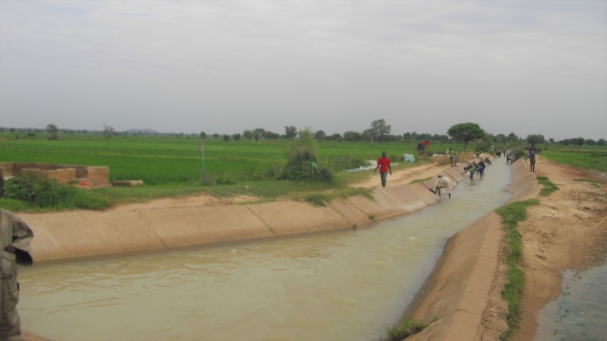
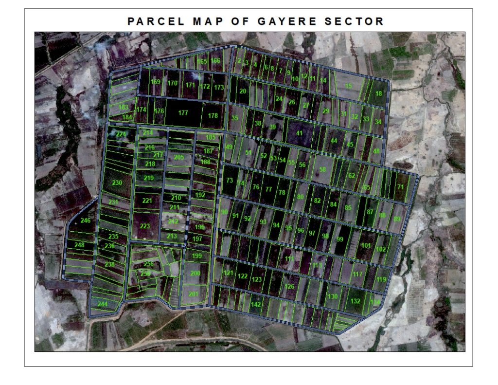
The Nigerian government received funds from the World Bank for the restoration of the irrigation channel. But before the World Bank approved funding, it required the preparation and implementation of a resettlement action plan for those affected. Sustainability Limited, the contracted to design and implement the plan, sub-contracted Geospatial Research Ltd., to delineate farm plots, households and economic tree crops using satellite imagery. Geospatial Research Ltd. is a Nigerian company with six years of experience in the field of geospatial business, land surveying and agribusiness advisory services. We were asked to map over 22,000 hectares of land using a high-resolution satellite imagery and GPS technology between September and November 2016.
Team work
The composition of our team was a critical factor behind the success of the project. Our team included negotiators, a surveyor, a socio-economic expert and an interpreter. The responsibilities of the negotiators were to have meetings with the different stakeholders, while the surveyor were to measure the size of the land. The socio-economic expert coordinated and analysed the socio-economic data, and the interpreter helped the project team communicate with all farmers, translating between Hausa and English. Based on their own expertise, all team members contributed to the development the project design.
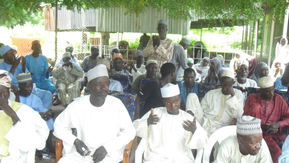
The team met with farmers, representatives of the Ministry of Water Resources and of the Ministry of Agriculture, and with community leaders. These consultations helped the smooth running of the operation. The majority of these stakeholders provided important information, like preferred meeting locations for each sector, the right contact people in each sector, etc. We engaged a total of 60 community members as “ad hoc staff” and trained them in the use of GPS and of the “Open Data Kit”, a tool for capturing socio-economic data. We organized them into teams of two: one of them mapped a specified parcel of land, while the other collected socio-economic data like names, ages, gender, household composition and other personal and household information. Prior informed consent was obtained from the respondents in terms of their personal data collection, storage and handling.
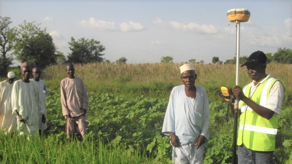
For the detailed mapping of the farmland, the enumerators used a differential and handheld GPS for farm delineation. Captured data points were overlaid on satellite imagery for individual plot delineation. We geotagged trees with an economic function, and in this way we were able to evaluate the value of different holdings. We then plotted the GPS coordinates of each farmland in ArcGIS – a computer program intended for working with maps and geographic information – and added personal and household data for analysis and the presentation of the mapped land. A unique identification number was given to each farmer, so they could identify their land on the map. We collected the data from the enumerator teams every day. We tried to assure data quality by minimizing possible errors, by plotting the GPS coordinates and ensuring that data was captured completely. The GPS coordinates were plotted to produce a survey plan for each plot, and farm sizes were computed accordingly.
For the first time in history, these farmers were able to access detailed and accurate data about their farmland, which is critical to their ability to access credit. Moreover, the compensation they would receive through the resettlement plan was computed on the basis of the size of each farm and the number of standing trees with economic value. These inconvenience allowances were paid to the farmers before the main construction took place.
Success and challenges
After six months, we delineated more than 23,000 farm plots and gathered the farmers’ socio-economic data. During the period in which the project was carried out, only rice was grown, making the work easier because there was little variation in the images of the cultivated fields. It helped that the weather was favourable, without rain, throughout our six-month stay in Kano.
The project took twice as long as planned due to the different challenges we faced when working with farmers and with the other local stakeholders. Sometimes farmers were not on the ground when the data capturing was going on. Some female landowners did not join the exercise because their religious beliefs do not allow a stranger to see their face. Some farmers thought we were governmental tax collectors, discouraging them from participating in the exercise. Moreover, the language barrier between project team members and the local participants sometimes led to small discussions and conflicts. The project team discussed these challenges with the client, and organised a town-hall meeting with the key stakeholders and the villagers, emphasising the importance of the data collection exercise, and the need to complete it. With such meetings, and by engaging many local community members as enumerators, we were able to work successfully with the local people within the project area.
Due to the distance between our only operational base and each of the areas in which we worked, the staff had to spend considerable time travelling down to the base. It was not possible to use our phones, and the road network was bad, which made navigation uneasy and communications difficult. We did not have internet service to upload our data on a daily basis, and we had to connect each device to the computer for downloading the data. On the other hand, the landscape was relatively flat and with few trees, which made navigation within the farmlands easy and fast. There was no interference with the GPS signal because there were no telecom masts or powerlines around. The GPS signals were also not disturbed by the canopy.
Lessons learned
In conclusion, carrying out the mapping process for the resettlement action plan for farmers in Kano Irrigation Scheme required a lot of effort in terms of project planning, resources and time to achieve the desired results. The engagement of community youth as data collectors and translators helped achieve positive results. They were able to relate the vision and mission of the project to the farmers, especially after a training course with our team. The town hall meeting with each community was a game changer for the exercise. This is where we discussed ‘compensation’, which was the major catalyst for convincing farmers to make themselves available on the field for the sharing of data.
About the author:
Kayode Omolaye
Principal Consultant
Geospatial Research Limited
info@georeslimited.com, georeslimited@gmail.com
+2347039806880, +2348059819434
www.georeslimited.com